Researchers: Madeleine Kotzagiannidis, Angelica Aviles-Rivero, Rihuan Ke, Carola-Bibiane Schönlieb, David Coomes, James Woodcock, and Rahul Goel
India faces tremendous societal and ecological challenges. Cities are growing which is accompanied by an increase in population and consequently traffic. Transport in India's cities plays an important role in air pollution and a large volume of road traffic fatalities. At the same time, while India's forest cover is on average increasing, it is not clear how much of this is due to plantation in contrast to natural forest, a knowledge gap that is possibly endangering biodiversity of India's forests.
Standardly collected remote sensing data of India offers a great opportunity for quantifying the status quo of these factors and turning them into ecological and health models that can inform new government policies to help tackle these challenges.
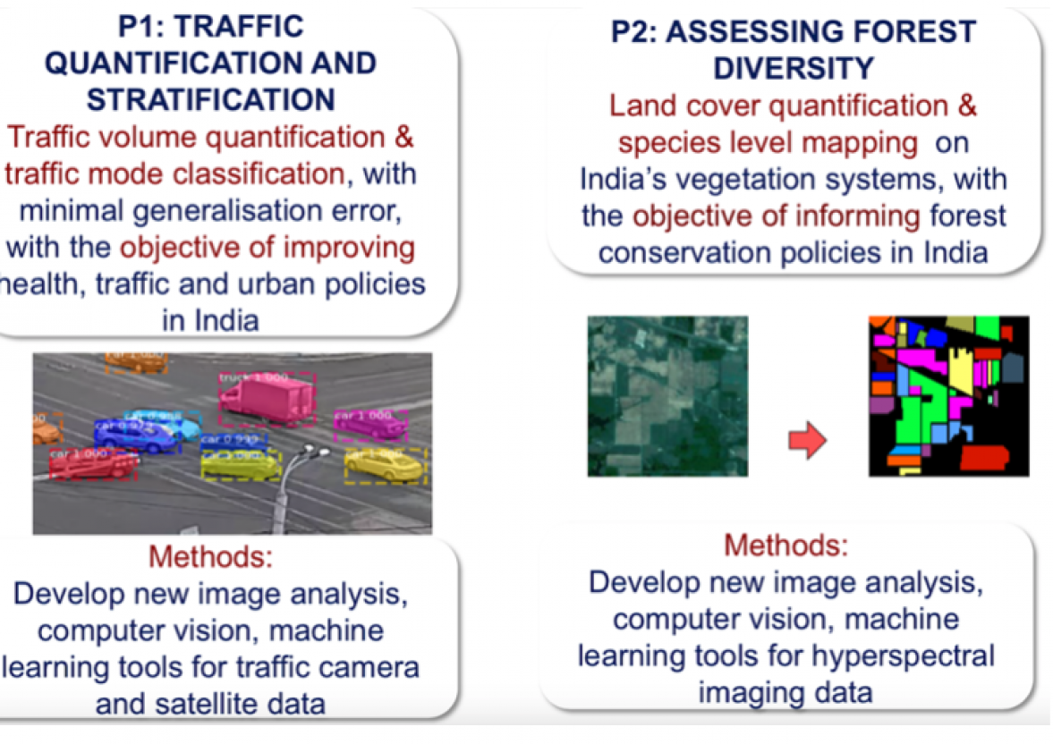
In this project, we will develop novel mathematical methods that can unlock the wealth of information contained in remote sensing data, with a focus on improving upon two of India's challenges: traffic management and forest conservation.
We will focus on the development of novel image analysis methods for quantifying traffic volume stratified with respect to traffic mode, i.e. car, bus, tuk tuk, lory, bicycle, pedestrian etc. Our analysis will focus on some of the most populated and polluted cities in India such as Dehli, Mumbai and Bengaluru, using image data obtained from satellites combined with more localised traffic camera data. Algorithms developed in the project as well as associated statistics drawn from the data will be made available to the general public as well as communicated to relevant stakeholders in India.
In the context of forest conservation, our project will develop new algorithms for mapping different tree species from India's forests from satellite data.
Supported by an interdisciplinary project team of researchers and stakeholders from academia and industry, and from India and Cambridge, and by tightly combining the development of novel mathematical methods for remote sensing data with knowledge transfer, our project aims to provide a step change towards improved decision making in traffic and forest policies in India.
This project has its own website.